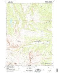
1967 Map of Darwin Peak
USGS Topo · Published 1995About this map
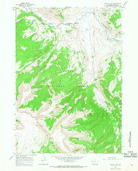
Gros Ventre Wilderness occupies the central and southern reaches of this high-country survey, dominated by a rugged drainage network flowing into the Gros Ventre River. Rising to a literal summit at Darwin Peak, the landscape is defined by its isolation and limited human infrastructure, marked primarily by a web of Pack Trails used by hunters and backcountry travelers. These trails connect remote landmarks like Cowboy Camp and the cluster of water bodies known as The Six Lakes. The northern portion of the map transitions into the Bridger-Teton National Forest, where the topography is split by Sportsman Ridge. Along the river, notable hydrological features such as Upper Falls and Chateau Lake suggest a landscape of significant relief and active alpine erosion. This 1967 field-checked data preserves the primitive character of the Teton and Sublette county border before more modern recreational pressures.
Find a feature on this map
26 named features on this map. Tap any name to fly to it.
Don’t see what you’re looking for? This feature index may not catch every label — zoom into the map to look around manually.
Map Details
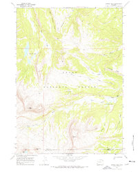
Editions of this 1967 Darwin Peak Map
2 editions found
Other maps of this area

1902 · Mt Leidy
USGS Topo · 1:125,000

1907 · Gros Ventre
USGS Topo · 1:125,000

1910 · Gros Ventre
USGS Topo · 1:125,000

1955 · Driggs
USGS Topo · 1:250,000

1958 · Driggs
USGS Topo · 1:250,000

1962 · Driggs
USGS Topo · 1:250,000
1965 · Upper Slide Lake
USGS Topo · 1:24,000
1965 · Burnt Mountain
USGS Topo · 1:24,000
1965 · Grizzly Lake
USGS Topo · 1:24,000
1967 · Tosi Peak
USGS Topo · 1:24,000