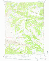
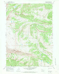
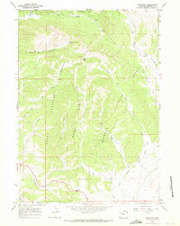
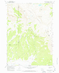
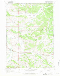
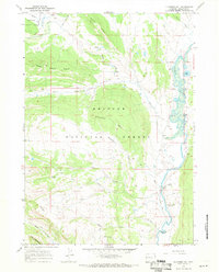
1967 Map of Tosi Peak
USGS Topo · Published 1970About this map
Tosi Peak and the high alpine terrain of the Gros Ventre Range dominate this mid-century survey of the Wyoming wilderness. The landscape is defined by the intersection of the Teton National Forest and the Bridger National Forest, where the complex drainage systems of Tosi Creek, Tepee Creek, and Clear Creek carve through the high country. A network of pack trails and jeep trails provides the only evidence of human passage through the Sawtooth Range and across Elk Ridge, connecting points of interest like the Water Dog Lakes and Coyote Basin. These trails suggest a history of seasonal grazing and forest management rather than permanent settlement. The presence of several named draws, such as Beaver Dam Draw and Cabin Draw, points to a landscape shaped by both natural hydrology and early mountain ranching or trapping activities.
Find a feature on this map
30 named features on this map. Tap any name to fly to it.
Don’t see what you’re looking for? This feature index may not catch every label — zoom into the map to look around manually.
Map Details
Editions of this 1967 Tosi Peak Map
2 editions found
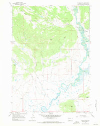
Other maps of this area

1907 · Gros Ventre
USGS Topo · 1:125,000

1910 · Gros Ventre
USGS Topo · 1:125,000

1955 · Driggs
USGS Topo · 1:250,000

1958 · Driggs
USGS Topo · 1:250,000

1962 · Driggs
USGS Topo · 1:250,000
1966 · Pass Peak
USGS Topo · 1:24,000
1966 · Dodge Butte
USGS Topo · 1:24,000
1967 · Doubletop Peak
USGS Topo · 1:24,000
1967 · Raspberry Ridge
USGS Topo · 1:24,000
1967 · Klondike Hill
USGS Topo · 1:24,000