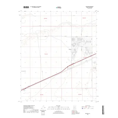
2018 Map of Dateland
USGS Topo · Published 2018About this map
Dateland serves as the central hub of this desert landscape in eastern Yuma County, positioned where modern transit corridors intersect with the arid expanses of the San Cristobal Valley. The settlement's residential grid is prominently displayed, featuring a network of Spanish-named thoroughfares such as Camino Del Sol and Cam Del Rojo north of the primary highway. To the southwest, the smaller settlement of Stoval marks a point along the transportation route as it traverses the valley floor. The northern boundary of the map is defined by the course of the Gila River, a critical water source that contrasts with the surrounding desert environment. Rising to the southeast, the Aztec Hills provide a distinct topographic break from the flat valley, illustrating the geological character of the region. The map captures a high degree of planned infrastructure in Dateland, including residential streets like Belmont Dr and Tamarisk Rd, reflecting late 20th-century development patterns in the Arizona desert.
Find a feature on this map
66 named features on this map. Tap any name to fly to it.
Don’t see what you’re looking for? This feature index may not catch every label — zoom into the map to look around manually.
Map Details
Editions of this 2018 Dateland Map
This is the sole edition of this map. No revisions or reprints were ever made.
Other maps of this area

1927 · Aguila Mountains
USGS Topo · 1:48,000

1927 · Kim
USGS Topo · 1:62,500

1929 · Aztec
USGS Topo · 1:62,500

1930 · Aguila Mountains
USGS Topo · 1:62,500

1930 · Stoval
USGS Topo · 1:62,500

1931 · Kim
USGS Topo · 1:62,500

1950 · Stoval
USGS Topo · 1:62,500

1950 · Aztec
USGS Topo · 1:62,500

1953 · Ajo
USGS Topo · 1:250,000

1957 · Ajo
USGS Topo · 1:250,000