
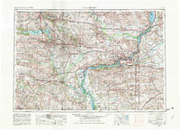
1958 Map of Davenport
USGS Topo · Published 1968About this map
The Mississippi River serves as the industrial and geographic spine of this mid-century survey, anchoring the Quad Cities of Davenport, Rock Island, and Moline. The river corridor is flanked by significant conservation efforts, including the Mark Twain NWR and the Loud Thunder State Forest Preserve. This 1958 state of the land reflects a period of significant water management and recreation development, prominently featuring the recently established Coralville Reservoir on the Iowa River north of Iowa City.
Find a feature on this map
153 named features on this map. Tap any name to fly to it.
Don’t see what you’re looking for? This feature index may not catch every label — zoom into the map to look around manually.
Map Details
Editions of this 1958 Davenport Map
2 editions found
Other maps of this area

1887 · Cedar Rapids
USGS Topo · 1:62,500

1888 · Shellsburg
USGS Topo · 1:62,500

1888 · Marion
USGS Topo · 1:62,500

1888 · Amana
USGS Topo · 1:62,500

1889 · Tipton
USGS Topo · 1:62,500

1889 · Marion
USGS Topo · 1:62,500

1889 · Amana
USGS Topo · 1:62,500

1889 · Shellsburg
USGS Topo · 1:62,500

1890 · Durant
USGS Topo · 1:62,500

1890 · Tipton
USGS Topo · 1:62,500