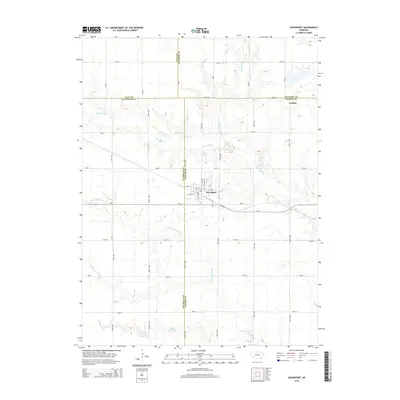
2014 Map of Davenport
USGS Topo · Published 2014About this map
Davenport sits at the convergence of four Nebraska counties, anchoring a rural landscape defined by the drainage of Big Sandy Cr and its tributaries. This 2014 survey captures the precise intersection of Thayer, Nuckolls, Clay, and Fillmore counties, where the village layout is detailed through street-level labels like N Linden Ave and W 8th St. The surrounding agricultural lands are punctuated by water management features such as Schroeder Reservoir and Jagels Reservoir, reflecting the region's reliance on managed water resources for its farming economy.
Find a feature on this map
39 named features on this map. Tap any name to fly to it.
Don’t see what you’re looking for? This feature index may not catch every label — zoom into the map to look around manually.
Map Details
Editions of this 2014 Davenport Map
This is the sole edition of this map. No revisions or reprints were ever made.
Other maps of this area

1898 · Hebron
USGS Topo · 1:125,000

1955 · Lincoln
USGS Topo · 1:250,000

1957 · Lincoln
USGS Topo · 1:250,000

1958 · Lincoln
USGS Topo · 1:250,000

1960 · Edgar
USGS Topo · 1:24,000

1960 · Davenport
USGS Topo · 1:24,000
1960 · Oak
USGS Topo · 1:24,000

1960 · Carleton
USGS Topo · 1:24,000
1960 · Ruskin
USGS Topo · 1:24,000
1960 · Deshler
USGS Topo · 1:24,000