
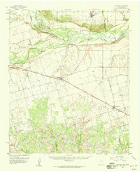
1958 Map of Davidson
USGS Topo · Published 1959About this map
The Red River and Pease River converge at the Oklahoma-Texas border, defining a landscape of riparian lowlands and agricultural plateaus in the late 1950s. On the Oklahoma side, Davidson serves as a northern anchor, while the Texas landscape to the south is marked by the busy Fort Worth and Denver (Burlington) line. This corridor connects small farming and rail outposts like Oklaunion, Elliott, and Harrold.
Find a feature on this map
33 named features on this map. Tap any name to fly to it.
Don’t see what you’re looking for? This feature index may not catch every label — zoom into the map to look around manually.
Map Details
Editions of this 1958 Davidson Map
2 editions found
Other maps of this area

1916 · Electra
USGS Topo · 1:24,000

1917 · Beaver Creek
USGS Topo · 1:24,000

1918 · Electra
USGS Topo · 1:31,680

1920 · Beaver Creek
USGS Topo · 1:31,680

1954 · Wichita Falls
USGS Topo · 1:250,000

1955 · Lawton
USGS Topo · 1:250,000

1958 · Wichita Falls
USGS Topo · 1:250,000

1958 · Frederick
USGS Topo · 1:62,500

1958 · Vernon
USGS Topo · 1:62,500

1958 · Electra
USGS Topo · 1:62,500