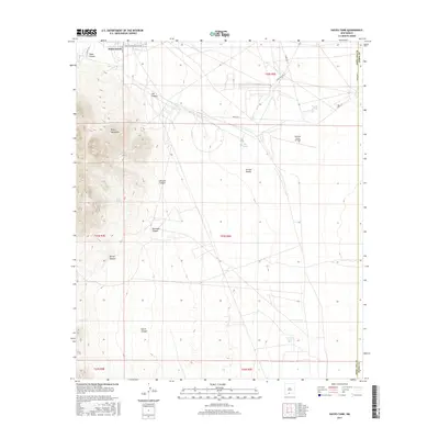
2017 Map of Davies Tank
USGS Topo · Published 2017About this map
White Sands defines the eastern expanse of this high-desert landscape, where the terrain shifts from the steep, jagged ridges of the Organ Mountains to the broad drainage basins of the Tularosa Valley. The map documents a critical military and aviation corridor, anchored by the Condron Army Airfield and a network of specialized service roads such as Wsmr P RT 3 and Wsmr S RD 219. This 2017 survey captures the vital water management infrastructure of the arid region, marking several catchment points including Davies Tank, Goodin Tank, and the naturally occurring Globe Spring. Numerous canyons carve through the western mountains, including Texas Canyon, Ash Canyon, and Johnson Canyon, while the Arroyo Salado serves as a primary drainage feature for the alluvial plains. The boundary between Doña Ana and Otero counties runs along the eastern edge, situating this area within the heart of the White Sands Missile Range.
Find a feature on this map
26 named features on this map. Tap any name to fly to it.
Don’t see what you’re looking for? This feature index may not catch every label — zoom into the map to look around manually.
Map Details
Editions of this 2017 Davies Tank Map
This is the sole edition of this map. No revisions or reprints were ever made.
Other maps of this area

1891 · Las Cruces
USGS Topo · 1:125,000

1893 · Las Cruces
USGS Topo · 1:125,000

1940 · Newman
USGS Topo · 1:62,500

1941 · Organ Peak
USGS Topo · 1:62,500

1943 · La Mesa
USGS Topo · 1:62,500

1943 · Parker Lake
USGS Topo · 1:62,500

1943 · Newman
USGS Topo · 1:62,500

1943 · Organ Peak
USGS Topo · 1:62,500

1948 · Davies Tank
USGS Topo · 1:24,000

1948 · Newman NW
USGS Topo · 1:24,000