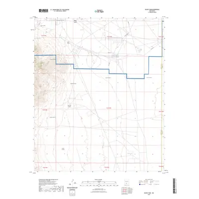
2023 Map of Davies Tank
USGS Topo · Published 2023About this map
Organ Mountains dominate the western edge of this desert landscape, where steep slopes give way to a network of drainage basins. The area is defined by massive military and federal installations, specifically the White Sands Missile Range and the northern reaches of Fort Bliss, which together occupy a significant portion of the eastern and central terrain. These boundaries intersect at the southern edge of the White Sands region, creating a highly restricted landscape where natural features and tactical infrastructure coexist. Scattered water sources like Texas Canyon Spring and Globe Spring provide rare hydrologic points in an otherwise arid environment characterized by significant landforms such as Arroyo Salado and Johnson Canyon. Infrastructure is primarily limited to military routes like Wsmr P RT 1 and isolated landmarks such as Davies Tank.
Find a feature on this map
32 named features on this map. Tap any name to fly to it.
Don’t see what you’re looking for? This feature index may not catch every label — zoom into the map to look around manually.
Map Details
Editions of this 2023 Davies Tank Map
This is the sole edition of this map. No revisions or reprints were ever made.
Other maps of this area

1891 · Las Cruces
USGS Topo · 1:125,000

1893 · Las Cruces
USGS Topo · 1:125,000

1940 · Newman
USGS Topo · 1:62,500

1941 · Organ Peak
USGS Topo · 1:62,500

1943 · La Mesa
USGS Topo · 1:62,500

1943 · Parker Lake
USGS Topo · 1:62,500

1943 · Newman
USGS Topo · 1:62,500

1943 · Organ Peak
USGS Topo · 1:62,500

1948 · Davies Tank
USGS Topo · 1:24,000

1948 · Newman NW
USGS Topo · 1:24,000