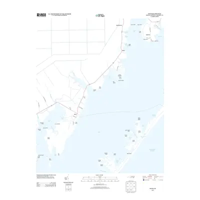
2013 Map of Davis
USGS Topo · Published 2013About this map
Core Sound separates the coastal mainland of Carteret County from a chain of barrier islands and marshy outcrops, creating a landscape defined by maritime trade and fishing traditions. The mainland settlements of Davis, Stacy, and Sealevel are clustered along the corridor of Route 70, where the land fragments into intricate points and necks such as Cedar Point and Long Point. At Davis Landing, the map shows the transition from local roads to the expansive waters of Jarrett Bay and Brett Bay. This 2013 survey illustrates the modern configuration of these fishing communities and the surrounding islands, including Horse Island and Great Island, before the continuous shifting of the Outer Banks and tidal marshes further alters the shoreline. The intricate naming of minor features like Salters Lumps and The Swash reflects a long history of local navigation through these shallow coastal waters.
Find a feature on this map
73 named features on this map. Tap any name to fly to it.
Don’t see what you’re looking for? This feature index may not catch every label — zoom into the map to look around manually.
Map Details
Editions of this 2013 Davis Map
This is the sole edition of this map. No revisions or reprints were ever made.
Other maps of this area

1949 · Atlantic
USGS Topo · 1:24,000

1949 · Styron Bay
USGS Topo · 1:24,000

1949 · Long Bay
USGS Topo · 1:24,000

1949 · Williston
USGS Topo · 1:24,000

1949 · Harkers Island
USGS Topo · 1:24,000

1949 · South River
USGS Topo · 1:24,000

1949 · Davis
USGS Topo · 1:24,000

1950 · Horsepen Point
USGS Topo · 1:24,000

1950 · Long Bay
USGS Topo · 1:24,000

1950 · South River
USGS Topo · 1:24,000