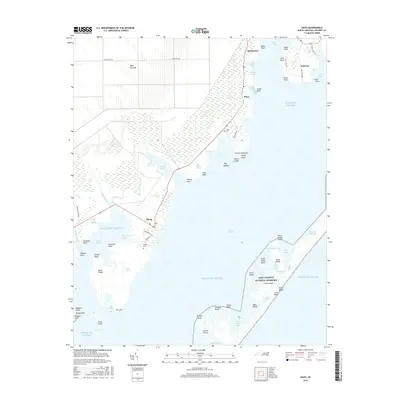
2016 Map of Davis
USGS Topo · Published 2016About this map
The coastal settlements of Davis, Stacy, and Sealevel anchor this maritime survey of the Outer Banks region, where the mainland gives way to the vast waters of Core Sound. To the east, the barrier islands of the Cape Lookout National Seashore protect the inner marshes and bays, featuring landmarks like the Core Banks and Great Island. This map reveals a landscape deeply defined by the tide, from the intricate wetlands of Broad Creek Marsh and Davis Marsh to the sheltered waters of Jarrett Bay. Local heritage is preserved in sites like the Stacy Cem and Murphy Cem, while the inland area known as Open Grounds suggests the large-scale reclamation projects of the late 20th century. The transport network of Nelson Bay Rd and Stacy Loop Rd connects these fishing communities, tracing the edge of the sound where life is bound to the water.
Find a feature on this map
74 named features on this map. Tap any name to fly to it.
Don’t see what you’re looking for? This feature index may not catch every label — zoom into the map to look around manually.
Map Details
Editions of this 2016 Davis Map
This is the sole edition of this map. No revisions or reprints were ever made.
Other maps of this area

1949 · Atlantic
USGS Topo · 1:24,000

1949 · Styron Bay
USGS Topo · 1:24,000

1949 · Long Bay
USGS Topo · 1:24,000

1949 · Williston
USGS Topo · 1:24,000

1949 · Harkers Island
USGS Topo · 1:24,000

1949 · South River
USGS Topo · 1:24,000

1949 · Davis
USGS Topo · 1:24,000

1950 · Horsepen Point
USGS Topo · 1:24,000

1950 · Long Bay
USGS Topo · 1:24,000

1950 · South River
USGS Topo · 1:24,000