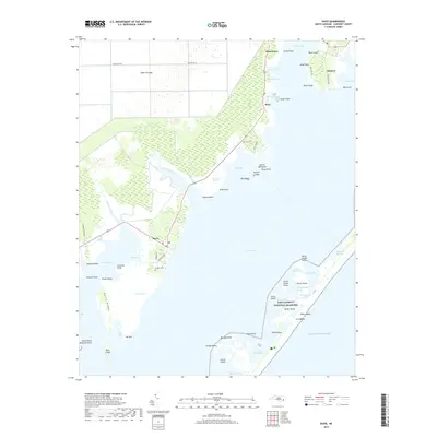
2019 Map of Davis
USGS Topo · Published 2019About this map
The coastal hamlets of Davis, Stacy, and Sealevel anchor this coastal Carteret County survey, illustrating the intricate relationship between the Outer Banks and the mainland. Along the edge of Core Sound, the landscape is a complex network of marshes and points, including King Point Marsh and the Broad Creek Marsh. The map provides significant detail for maritime history and genealogy, noting family-named sites such as Murphy Cem near Davis and Stacy Cem to the north.
Find a feature on this map
71 named features on this map. Tap any name to fly to it.
Don’t see what you’re looking for? This feature index may not catch every label — zoom into the map to look around manually.
Map Details
Editions of this 2019 Davis Map
This is the sole edition of this map. No revisions or reprints were ever made.
Other maps of this area

1949 · Atlantic
USGS Topo · 1:24,000

1949 · Styron Bay
USGS Topo · 1:24,000

1949 · Long Bay
USGS Topo · 1:24,000

1949 · Williston
USGS Topo · 1:24,000

1949 · Harkers Island
USGS Topo · 1:24,000

1949 · South River
USGS Topo · 1:24,000

1949 · Davis
USGS Topo · 1:24,000

1950 · Horsepen Point
USGS Topo · 1:24,000

1950 · Long Bay
USGS Topo · 1:24,000

1950 · South River
USGS Topo · 1:24,000