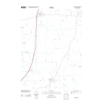
2013 Map of Davis City
USGS Topo · Published 2013About this map
Davis City and Decatur City anchor this portion of southern Iowa, where the landscape is defined by the winding course of the Thompson River. The settlement pattern follows a mix of early rural villages and modern transport corridors, with Interstate 35 cutting a north-south path through the center. Small hamlets such as Terre Haute, Barrell, and Blockly are interspersed among the drainages of Potteroff Cr and McGruder Creek. The map documents a highly structured road network, from the residential streets like National St in Decatur City to the more remote river crossings at the Grand River Bridge. This 2013 survey illustrates the persistence of these small communities within the context of Iowa's agricultural heartland, capturing the relationship between historic towns and the primary watercourses of Dickersons Br and the West Little River.
Find a feature on this map
68 named features on this map. Tap any name to fly to it.
Don’t see what you’re looking for? This feature index may not catch every label — zoom into the map to look around manually.
Map Details
Editions of this 2013 Davis City Map
This is the sole edition of this map. No revisions or reprints were ever made.
Other maps of this area

1945 · Lamoni
USGS Topo · 1:62,500

1947 · Lamoni
USGS Topo · 1:62,500

1954 · Centerville
USGS Topo · 1:250,000

1957 · Centerville
USGS Topo · 1:250,000

1958 · Centerville
USGS Topo · 1:250,000

1964 · Pleasanton
USGS Topo · 1:24,000

1964 · Leon
USGS Topo · 1:24,000

1965 · Garden Grove SW
USGS Topo · 1:24,000
1981 · Van Wert
USGS Topo · 1:24,000
1981 · Lamoni South
USGS Topo · 1:24,000