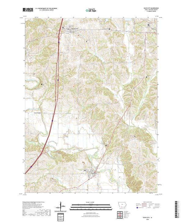
2022 Map of Davis City
USGS Topo · Published 2022About this map
Davis City sits at the southern edge of this Decatur County landscape, where the Thompson River winds southward through a terrain defined by its numerous small tributaries. The area is marked by a dense concentration of burial grounds, including the Davis City Cem, Gore Cem, and Bethel Cem, which offer significant touchpoints for local genealogical research. To the north, Decatur City and the western outskirts of Leon anchor the map, connected by a network of rural roads such as Terre Haute Rd and Co Rd R30. The presence of the Little River Scenic Pathway Trl near the W Little River highlights modern recreational use overlaid on a traditional agricultural and riverine environment. Smaller settlements like Terre Haute and family-named landmarks such as Walter Cem and Miller Cem provide a look at the historical settlement patterns of the Grand River township area.
Find a feature on this map
50 named features on this map. Tap any name to fly to it.
Don’t see what you’re looking for? This feature index may not catch every label — zoom into the map to look around manually.
Map Details
Editions of this 2022 Davis City Map
This is the sole edition of this map. No revisions or reprints were ever made.
Other maps of this area

1945 · Lamoni
USGS Topo · 1:62,500

1947 · Lamoni
USGS Topo · 1:62,500

1954 · Centerville
USGS Topo · 1:250,000

1957 · Centerville
USGS Topo · 1:250,000

1958 · Centerville
USGS Topo · 1:250,000

1964 · Pleasanton
USGS Topo · 1:24,000

1964 · Leon
USGS Topo · 1:24,000

1965 · Garden Grove SW
USGS Topo · 1:24,000
1981 · Van Wert
USGS Topo · 1:24,000
1981 · Lamoni South
USGS Topo · 1:24,000