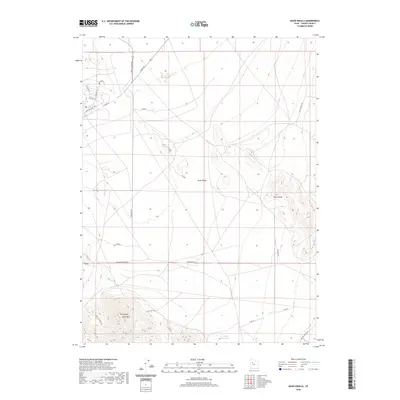
2020 Map of Davis Knolls
USGS Topo · Published 2020About this map
Skull Valley defines the arid character of this Tooele County landscape, where the flat basin floor meets the rising elevations of the Davis Knolls. The map reveals a grid of straight-line access routes and section lines, including One Half Section Rd and Surveyors Rd, which suggest the structured management of this open range. Near the southern edge of the sheet, Round Top Davis Mtn stands as a prominent landmark above the surrounding topography. Water resources are scarce and localized, represented by the Valley Reservoir and the intermittent drainage of Dry Cr. These features, along with a network of corridors like Hatch Well Rd and Simpson Springs Rd, illustrate how human movement and livestock management have been adapted to the high desert environment of the Great Basin.
Find a feature on this map
22 named features on this map. Tap any name to fly to it.
Don’t see what you’re looking for? This feature index may not catch every label — zoom into the map to look around manually.
Map Details
Editions of this 2020 Davis Knolls Map
This is the sole edition of this map. No revisions or reprints were ever made.
Other maps of this area

1885 · Tooele Valley
USGS Topo · 1:250,000

1953 · Tooele
USGS Topo · 1:250,000

1955 · Tabbys Peak SE
USGS Topo · 1:24,000

1955 · Simpson Springs
USGS Topo · 1:24,000

1955 · Indian Peaks
USGS Topo · 1:24,000

1955 · Camels Back Ridge NE
USGS Topo · 1:24,000

1955 · Davis Knolls
USGS Topo · 1:24,000

1955 · Deseret Peak
USGS Topo · 1:62,500

1955 · Tooele
USGS Topo · 1:250,000

1971 · Onaqui Mts South
USGS Topo · 1:24,000