
1971 Map of Onaqui Mts South
USGS Topo · Published 1974About this map
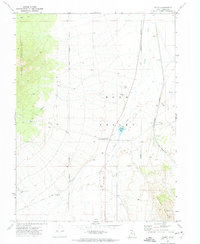
The Pony Express Road skirts the southern edge of the high country in this early 1970s survey, following a route historically vital to transcontinental communication. This landscape is defined by the sharp rise of the Onaqui Mountains, where steep drainages like Skull Faust Canyon, Hellhole Canyon, and Rock Canyon cut through the western slopes. Water sources are scarce but critical in this arid environment, marked by Hellhole Spring and Rock Canyon Spring. To the east, the terrain descends into the broad expanse of Rush Valley, where a modern Aqueduct parallels the mountain range. The map also records early industrial and resource extraction activity through scattered Quarries, a Prospect, and a Borrow Pit, while numerous Jeep Trails provide access through the rugged foothills of Davis Knolls and Post Hollow.
Find a feature on this map
24 named features on this map. Tap any name to fly to it.
Don’t see what you’re looking for? This feature index may not catch every label — zoom into the map to look around manually.
Map Details
Editions of this 1971 Onaqui Mts South Map
This is the sole edition of this map. No revisions or reprints were ever made.
Other maps of this area

1885 · Tooele Valley
USGS Topo · 1:250,000

1918 · Stockton
USGS Topo · 1:62,500

1953 · Tooele
USGS Topo · 1:250,000

1955 · Indian Peaks
USGS Topo · 1:24,000

1955 · Davis Knolls
USGS Topo · 1:24,000

1955 · Deseret Peak
USGS Topo · 1:62,500

1955 · Stockton
USGS Topo · 1:62,500

1955 · Tooele
USGS Topo · 1:250,000
1971 · Faust
USGS Topo · 1:24,000
1971 · Vernon
USGS Topo · 1:24,000