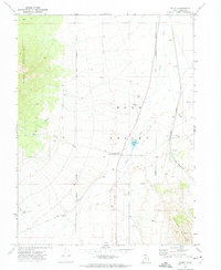
1971 Map of Faust
USGS Topo · Published 1974About this map
Rush Valley unfolds between the Onaqui Mountains and the Vernon Hills, revealing a landscape defined by its transit history and sparse ranching infrastructure. In the early 1970s, the area remained a critical corridor for both historical memory and modern logistics. The presence of the Historical Marker Faust Pony Express Station along the Pony Express Road anchors the map in the mid-19th-century mail route era, while the Union Pacific railroad and a nearby Landing Strip represent successive waves of transportation technology.
Find a feature on this map
24 named features on this map. Tap any name to fly to it.
Don’t see what you’re looking for? This feature index may not catch every label — zoom into the map to look around manually.
Map Details
Editions of this 1971 Faust Map
This is the sole edition of this map. No revisions or reprints were ever made.
Other maps of this area

1885 · Tooele Valley
USGS Topo · 1:250,000

1918 · Stockton
USGS Topo · 1:62,500

1953 · Tooele
USGS Topo · 1:250,000

1955 · Deseret Peak
USGS Topo · 1:62,500

1955 · Stockton
USGS Topo · 1:62,500

1955 · Tooele
USGS Topo · 1:250,000
1971 · Vernon NE
USGS Topo · 1:24,000

1971 · Onaqui Mts South
USGS Topo · 1:24,000
1971 · Vernon
USGS Topo · 1:24,000
1971 · Lookout Pass
USGS Topo · 1:24,000