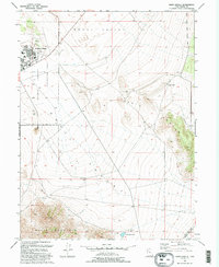
1993 Map of Davis Knolls
USGS Topo · Published 1993About this map
English Village serves as the residential anchor for the northwestern corner of this map, situated within the Dugway Proving Ground. This military landscape includes specialized infrastructure like a Hospital, High Sch, and a Radio Facility, illustrating the self-contained nature of the base. The surrounding terrain of Skull Valley is defined by its arid character, where water sources like Hatch Well and the Valley Reservoir were critical for survival and movement through the high desert.
Find a feature on this map
16 named features on this map. Tap any name to fly to it.
Don’t see what you’re looking for? This feature index may not catch every label — zoom into the map to look around manually.
Map Details
Editions of this 1993 Davis Knolls Map
This is the sole edition of this map. No revisions or reprints were ever made.
Other maps of this area

1885 · Tooele Valley
USGS Topo · 1:250,000

1953 · Tooele
USGS Topo · 1:250,000

1955 · Tabbys Peak SE
USGS Topo · 1:24,000

1955 · Simpson Springs
USGS Topo · 1:24,000

1955 · Indian Peaks
USGS Topo · 1:24,000

1955 · Camels Back Ridge NE
USGS Topo · 1:24,000

1955 · Davis Knolls
USGS Topo · 1:24,000

1955 · Deseret Peak
USGS Topo · 1:62,500

1955 · Tooele
USGS Topo · 1:250,000

1971 · Onaqui Mts South
USGS Topo · 1:24,000