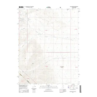
2014 Map of Davis Mountain
USGS Topo · Published 2014About this map
Davis Mtn and the White-Inyo Range dominate this high-desert landscape straddling the Nevada California border. The rugged topography is defined by a series of drainages, including Trail Cr, Middle Cr, and Chiatovich Cr, which flow eastward from the peaks toward Wildhorse Flat. The map records specific points of human activity and natural relief, such as the Red Rock Mine in the northern sector and the high-elevation Post Meadow.
Find a feature on this map
24 named features on this map. Tap any name to fly to it.
Don’t see what you’re looking for? This feature index may not catch every label — zoom into the map to look around manually.
Map Details
Editions of this 2014 Davis Mountain Map
This is the sole edition of this map. No revisions or reprints were ever made.
Other maps of this area

1917 · White Mountain
USGS Topo · 1:125,000

1947 · Mariposa
USGS Topo · 1:250,000

1948 · Mariposa
USGS Topo · 1:250,000

1957 · Mariposa
USGS Topo · 1:250,000

1962 · Benton
USGS Topo · 1:62,500

1962 · Mt. Barcroft
USGS Topo · 1:62,500

1962 · White Mtn. Peak
USGS Topo · 1:62,500

1963 · Mariposa
USGS Topo · 1:250,000

1963 · Davis Mountain
USGS Topo · 1:62,500
1987 · Volcanic Hills West
USGS Topo · 1:24,000