
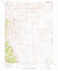
1963 Map of Davis Mountain
USGS Topo · Published 1965About this map
Fish Lake Valley dominates the eastern half of this high-altitude landscape along the Nevada and California border. In the early 1960s, this arid basin was supported by a network of springs and creeks descending from the heights of Davis Mountain and the Inyo National Forest to the west. Water sources such as Post Spring, Chiatovich Creek, and Sand Spring provided essential lifeblood for the Dyer Ranch and other valley operations.
Find a feature on this map
42 named features on this map. Tap any name to fly to it.
Don’t see what you’re looking for? This feature index may not catch every label — zoom into the map to look around manually.
Map Details
Editions of this 1963 Davis Mountain Map
2 editions found
Other maps of this area

1898 · Silver Peak
USGS Topo · 1:125,000

1900 · Silver Peak
USGS Topo · 1:125,000

1907 · Tonopah
USGS Topo · 1:250,000

1908 · Lida
USGS Topo · 1:250,000

1908 · Tonopah
USGS Topo · 1:250,000

1909 · Hawthorne
USGS Topo · 1:250,000

1911 · Hawthorne
USGS Topo · 1:250,000

1913 · Lida
USGS Topo · 1:250,000

1915 · Hawthorne
USGS Topo · 1:250,000

1917 · White Mountain
USGS Topo · 1:125,000