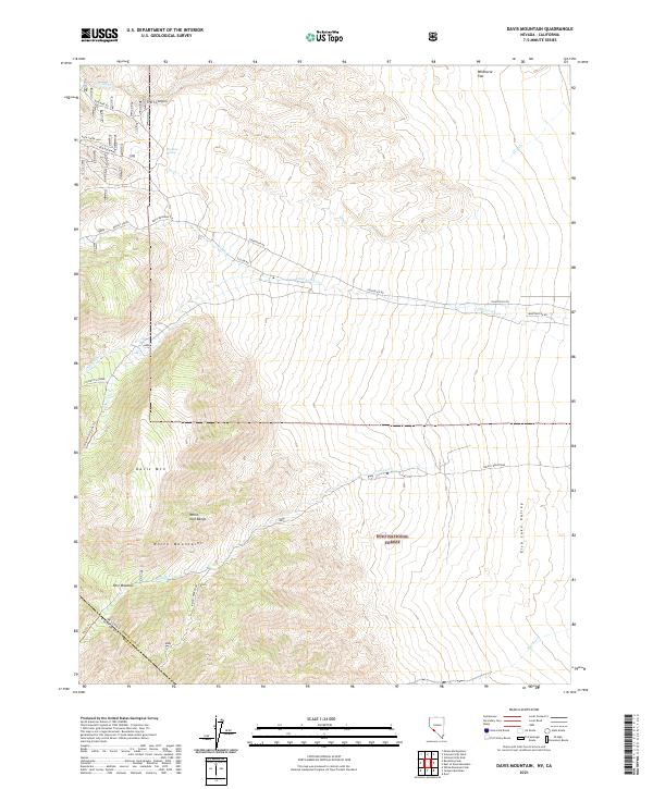
2021 Map of Davis Mountain
USGS Topo · Published 2021About this map
Davis Mtn and the White Mountains dominate this high-altitude landscape along the border of Nevada and California. Part of the Inyo National Forest, the terrain is defined by steep elevation changes and deep drainage systems like Trail Canyon and Fish Lake Valley. The presence of Red Rock Mine and the B&B Mine Rd indicates the area's legacy of extraction in the White- Inyo Range. Water is a critical but seasonal element here, with numerous ephemeral flows such as Chiatovich Cr, Dry Cr, and Indian Cr carving through the slopes. This modern survey illustrates how infrastructure like Chiatovich Rd and Gillum Rd navigates the complex topography to reach isolated sites like Post Meadow. The map provides a precise look at the jurisdictional overlap between Esmeralda and Mono Counties during the early 21st century.
Find a feature on this map
33 named features on this map. Tap any name to fly to it.
Don’t see what you’re looking for? This feature index may not catch every label — zoom into the map to look around manually.
Map Details
Editions of this 2021 Davis Mountain Map
This is the sole edition of this map. No revisions or reprints were ever made.
Other maps of this area

1917 · White Mountain
USGS Topo · 1:125,000

1947 · Mariposa
USGS Topo · 1:250,000

1948 · Mariposa
USGS Topo · 1:250,000

1957 · Mariposa
USGS Topo · 1:250,000

1962 · Benton
USGS Topo · 1:62,500

1962 · Mt. Barcroft
USGS Topo · 1:62,500

1962 · White Mtn. Peak
USGS Topo · 1:62,500

1963 · Mariposa
USGS Topo · 1:250,000

1963 · Davis Mountain
USGS Topo · 1:62,500
1987 · Volcanic Hills West
USGS Topo · 1:24,000