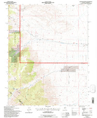
1994 Map of Davis Mountain
USGS Topo · Published 1997About this map
The Von Schmidt Line (1872) carves a historical path through this high-altitude landscape, marking the nineteenth-century effort to define the border between Nevada and California. Rising above the basin, Davis Mountain anchors the rugged terrain within the Inyo National Forest, where the land falls away into the broad expanse of Fish Lake Valley. The map documents a legacy of mountain mineral exploration, featuring the Mollini Mine, Red Rock Mine, and numerous prospects scattered across the slopes near Chiatovich Creek and Indian Creek. Evidence of early surveying remains preserved in specific markers like the Von Schmidts 334 Mile 61 Chain Post near Post Meadow. The settlement at McNett sits on the valley floor, positioned near the junction of mountain drainages and the arid flats of Wildhorse Flat.
Find a feature on this map
26 named features on this map. Tap any name to fly to it.
Don’t see what you’re looking for? This feature index may not catch every label — zoom into the map to look around manually.
Map Details
Editions of this 1994 Davis Mountain Map
This is the sole edition of this map. No revisions or reprints were ever made.
Other maps of this area

1917 · White Mountain
USGS Topo · 1:125,000

1947 · Mariposa
USGS Topo · 1:250,000

1948 · Mariposa
USGS Topo · 1:250,000

1957 · Mariposa
USGS Topo · 1:250,000

1962 · Benton
USGS Topo · 1:62,500

1962 · Mt. Barcroft
USGS Topo · 1:62,500

1962 · White Mtn. Peak
USGS Topo · 1:62,500

1963 · Mariposa
USGS Topo · 1:250,000

1963 · Davis Mountain
USGS Topo · 1:62,500
1987 · Volcanic Hills West
USGS Topo · 1:24,000