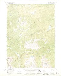
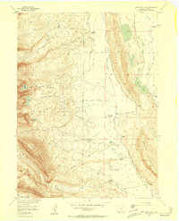
1955 Map of Davis Peak
USGS Topo · Published 1970About this map
Davis Peak stands as the central landmark in this mid-century survey of the high country along the Continental Divide. The landscape is dominated by the wild drainage basins of the Encampment River and Big Creek, where the topography transitions from the high summits of Red Elephant Mountain and Buck Mtn down into the glacial depressions of Seven Lakes and Lake Eileen. The Routt National Forest boundary envelopes most of the area, which is primarily accessible via primitive routes like the Stump Park Trail and West Fork Trail. To the north, the State Line marks the transition out of the Colorado high country, while to the south, the Sierra Madre range defines the horizon. This map records the wilderness state of the region before modern development, documenting natural features like Big Creek Falls and the extensive Beaver Ponds along the northeastern creek beds.
Find a feature on this map
29 named features on this map. Tap any name to fly to it.
Don’t see what you’re looking for? This feature index may not catch every label — zoom into the map to look around manually.
Map Details
Editions of this 1955 Davis Peak Map
5 editions found
Other maps of this area

1911 · Hahns Peak
USGS Topo · 1:125,000

1913 · Hahns Peak
USGS Topo · 1:125,000

1939 · Saratoga
USGS Topo · 1:125,000

1954 · Rawlins
USGS Topo · 1:250,000

1954 · Craig
USGS Topo · 1:250,000

1955 · Davis Peak
USGS Topo · 1:24,000

1955 · Mount Zirkel
USGS Topo · 1:24,000

1955 · Pearl
USGS Topo · 1:24,000
1956 · Boettcher Lake
USGS Topo · 1:24,000

1956 · Pearl
USGS Topo · 1:62,500