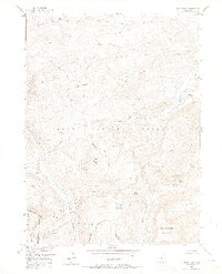
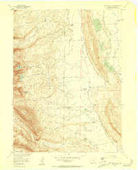
1955 Map of Davis Peak
USGS Topo · Published 1970About this map
Davis Peak rises as a central landmark within the Routt National Forest, marking a high-elevation landscape defined by the drainage of the Main Fork Encampment River and Big Creek. The terrain is characterized by a series of high parks and ridges, including Buffalo Ridge, Damfino Park, and Stump Park, which reflect a legacy of high-country grazing and transit. This is particularly evident in the presence of a mapped Stock Driveway that traverses the northern slopes of the ridge.
Find a feature on this map
27 named features on this map. Tap any name to fly to it.
Don’t see what you’re looking for? This feature index may not catch every label — zoom into the map to look around manually.
Map Details
Editions of this 1955 Davis Peak Map
5 editions found
Other maps of this area

1911 · Hahns Peak
USGS Topo · 1:125,000

1913 · Hahns Peak
USGS Topo · 1:125,000

1939 · Saratoga
USGS Topo · 1:125,000

1954 · Rawlins
USGS Topo · 1:250,000

1954 · Craig
USGS Topo · 1:250,000

1955 · Davis Peak
USGS Topo · 1:24,000

1955 · Mount Zirkel
USGS Topo · 1:24,000

1955 · Pearl
USGS Topo · 1:24,000
1956 · Boettcher Lake
USGS Topo · 1:24,000

1956 · Pearl
USGS Topo · 1:62,500