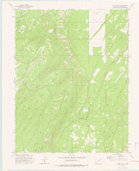
1973 Map of Davis Point
USGS Topo · Published 1976About this map
The Uncompahgre National Forest dominates this Montrose County landscape, where deep basins and high mesas dictate the flow of numerous waterways. The terrain is defined by dramatic elevation changes between features like Payne Mesa and Traver Mesa, with the land dropping into the Moore Basin and Horseshoe Basin. A network of drainage systems, including Roubideau Creek and Cushman Creek, carve through the high country. Historical land use is evidenced by the Coal Bank and the established routes of Transfer Road and Divide Road 3.4 Mi., which provide access through the forest. The topography indicates a working wilderness where landmarks like Davis Point and Oak Hill served as critical navigational markers for early surveyors and forest managers.
Find a feature on this map
42 named features on this map. Tap any name to fly to it.
Don’t see what you’re looking for? This feature index may not catch every label — zoom into the map to look around manually.
Map Details
Editions of this 1973 Davis Point Map
3 editions found
Other maps of this area

1956 · Moab
USGS Topo · 1:250,000

1959 · Moab
USGS Topo · 1:250,000

1960 · Moab
USGS Topo · 1:250,000

1962 · Moab
USGS Topo · 1:250,000
1962 · Hoovers Corner
USGS Topo · 1:24,000

1964 · Moab
USGS Topo · 1:250,000

1965 · Moab
USGS Topo · 1:250,000
1973 · Camel Back
USGS Topo · 1:24,000
1973 · Ute
USGS Topo · 1:24,000
1973 · Dry Creek Basin
USGS Topo · 1:24,000