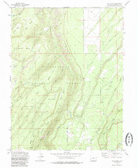
1973 Map of Davis Point
USGS Topo · Published 1985About this map
Uncompahgre National Forest dominates this 1973 survey, revealing a landscape defined by dramatic plateaus and deep drainage basins in Colorado. High-altitude mesas such as Payne Mesa and Traver Mesa are separated by the intricate networks of Roubideau Creek and its many tributaries, including Bull Creek and Pine Creek. The cartography highlights the vital access routes of the era, specifically the Transfer Road and Cushman Road, alongside numerous named trails like the Coal Bank Trail.
Find a feature on this map
36 named features on this map. Tap any name to fly to it.
Don’t see what you’re looking for? This feature index may not catch every label — zoom into the map to look around manually.
Map Details
Editions of this 1973 Davis Point Map
3 editions found
Other maps of this area

1956 · Moab
USGS Topo · 1:250,000

1959 · Moab
USGS Topo · 1:250,000

1960 · Moab
USGS Topo · 1:250,000

1962 · Moab
USGS Topo · 1:250,000
1962 · Hoovers Corner
USGS Topo · 1:24,000

1964 · Moab
USGS Topo · 1:250,000

1965 · Moab
USGS Topo · 1:250,000
1973 · Camel Back
USGS Topo · 1:24,000
1973 · Ute
USGS Topo · 1:24,000
1973 · Dry Creek Basin
USGS Topo · 1:24,000