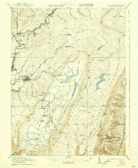
1921 Map of Davis
USGS Topo · Published 1938About this map
Backbone Mountain and the high plateaus of the Allegheny Front define this industrial and mountain landscape during the early twentieth century. The map captures the infrastructure of the timber and coal era, characterized by the extensive Lumber RR winding through the highlands and the Stony River Dam on the plateau. Along the Maryland and West Virginia border, the historic Fairfax Stone marks the headwaters of the North Branch Maryland Potomac River, surrounded by small company towns and settlements like Kempton, Wilsonia, and Dobbin.
Find a feature on this map
70 named features on this map. Tap any name to fly to it.
Don’t see what you’re looking for? This feature index may not catch every label — zoom into the map to look around manually.
Map Details
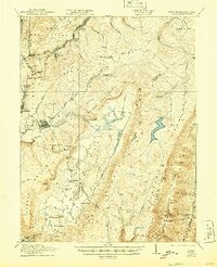
Editions of this 1921 Davis Map
2 editions found
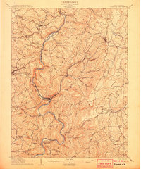
Other maps of this area

1886 · St. George
USGS Topo · 1:125,000

1889 · Beverly
USGS Topo · 1:125,000

1891 · St. George
USGS Topo · 1:125,000

1892 · Beverly
USGS Topo · 1:125,000

1892 · Franklin
USGS Topo · 1:125,000

1895 · Piedmont
USGS Topo · 1:125,000

1896 · Franklin
USGS Topo · 1:125,000

1899 · Oakland
USGS Topo · 1:62,500

1900 · Oakland
USGS Topo · 1:62,500
1907 · Kingwood
USGS Topo · 1:62,500