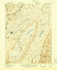
1921 Map of Davis
USGS Topo · Published 1944About this map
Fairfax Stone stands as a primary geographic anchor on this early 20th-century survey, marking the historic intersection of several West Virginia and Maryland county lines. This highland region is defined by the industrial activity of the Western Maryland RR and the Lumber RR, which supported the timber and coal economies centered around Thomas and Davis. The terrain transitions from the high ridges of Backbone Mountain to the broad expanse of the Canaan Valley, where a network of small country schools like Maple Grove School and Cortland School served remote farming and timbering communities. The presence of the Stony River Dam and numerous family-named landmarks, such as Bearden Knob and Cosner School, reflects a period when these rugged hills were intensely utilized for their natural resources before the widespread reforestation of the modern era.
Find a feature on this map
71 named features on this map. Tap any name to fly to it.
Don’t see what you’re looking for? This feature index may not catch every label — zoom into the map to look around manually.
Map Details
Editions of this 1921 Davis Map
2 editions found
Other maps of this area

1886 · St. George
USGS Topo · 1:125,000

1889 · Beverly
USGS Topo · 1:125,000

1891 · St. George
USGS Topo · 1:125,000

1892 · Beverly
USGS Topo · 1:125,000

1892 · Franklin
USGS Topo · 1:125,000

1895 · Piedmont
USGS Topo · 1:125,000

1896 · Franklin
USGS Topo · 1:125,000

1899 · Oakland
USGS Topo · 1:62,500

1900 · Oakland
USGS Topo · 1:62,500

1907 · Kingwood
USGS Topo · 1:62,500