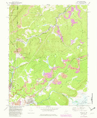
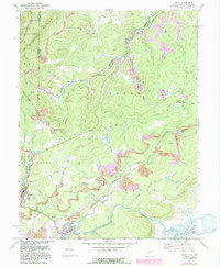
1967 Map of Davis
USGS Topo · Published 1982About this map
The Fairfax Stone marks the historical and geographical pivot point where Maryland and West Virginia meet, anchoring a landscape shaped by coal extraction and heavy rail. This high-altitude region is dominated by the industrial infrastructure of the Western Maryland railroad, which follows the winding course of the North Branch Potomac River. The settlement pattern reflects the era's mining economy, with numerous locations marked as Mines, Strip Mine, and Tipple sites near communities like Kempton and Wilsonia.
Find a feature on this map
51 named features on this map. Tap any name to fly to it.
Don’t see what you’re looking for? This feature index may not catch every label — zoom into the map to look around manually.
Map Details
Editions of this 1967 Davis Map
5 editions found
Other maps of this area

1886 · St. George
USGS Topo · 1:125,000

1891 · St. George
USGS Topo · 1:125,000

1895 · Piedmont
USGS Topo · 1:125,000

1899 · Oakland
USGS Topo · 1:62,500

1900 · Oakland
USGS Topo · 1:62,500

1907 · Kingwood
USGS Topo · 1:62,500

1908 · Parsons
USGS Topo · 1:62,500

1916 · Davis
USGS Topo · 1:48,000

1918 · Davis
USGS Topo · 1:62,500

1919 · Davis
USGS Topo · 1:62,500