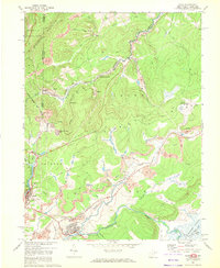
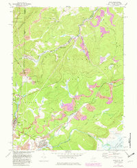
1967 Map of Davis
USGS Topo · Published 1972About this map
Backbone Mountain defines the northwest corner of this Maryland and West Virginia borderlands survey, where the North Branch Potomac River and the Western Maryland railroad corridor intersect a landscape of industrial extraction. The map captures a moment when the regional economy was heavily tied to mining, evidenced by numerous Strip Mines, a Tipple, and several Mine Dumps scattered between Kempton and Wilsonia.
Find a feature on this map
61 named features on this map. Tap any name to fly to it.
Don’t see what you’re looking for? This feature index may not catch every label — zoom into the map to look around manually.
Map Details
Editions of this 1967 Davis Map
5 editions found
Other maps of this area

1886 · St. George
USGS Topo · 1:125,000

1891 · St. George
USGS Topo · 1:125,000

1895 · Piedmont
USGS Topo · 1:125,000

1899 · Oakland
USGS Topo · 1:62,500

1900 · Oakland
USGS Topo · 1:62,500

1907 · Kingwood
USGS Topo · 1:62,500

1908 · Parsons
USGS Topo · 1:62,500

1916 · Davis
USGS Topo · 1:48,000

1918 · Davis
USGS Topo · 1:62,500

1919 · Davis
USGS Topo · 1:62,500