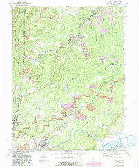
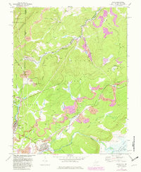
1967 Map of Davis
USGS Topo · Published 1982About this map
The Fairfax Stone marks the historical boundary between Maryland and West Virginia, serving as a cornerstone for this survey of the high plateau region. Industrial life in the mid-twentieth century is defined by the Western Maryland railroad, which threads through the valleys to serve the mines, tipples, and numerous strip mines that dominate the local economy. Settlements like Thomas and Davis are established along the Blackwater River, while smaller nodes such as Kempton and Wilsonia are clustered near the northern border.
Find a feature on this map
54 named features on this map. Tap any name to fly to it.
Don’t see what you’re looking for? This feature index may not catch every label — zoom into the map to look around manually.
Map Details
Editions of this 1967 Davis Map
5 editions found
Other maps of this area

1886 · St. George
USGS Topo · 1:125,000

1891 · St. George
USGS Topo · 1:125,000

1895 · Piedmont
USGS Topo · 1:125,000

1899 · Oakland
USGS Topo · 1:62,500

1900 · Oakland
USGS Topo · 1:62,500

1907 · Kingwood
USGS Topo · 1:62,500

1908 · Parsons
USGS Topo · 1:62,500

1916 · Davis
USGS Topo · 1:48,000

1918 · Davis
USGS Topo · 1:62,500

1919 · Davis
USGS Topo · 1:62,500