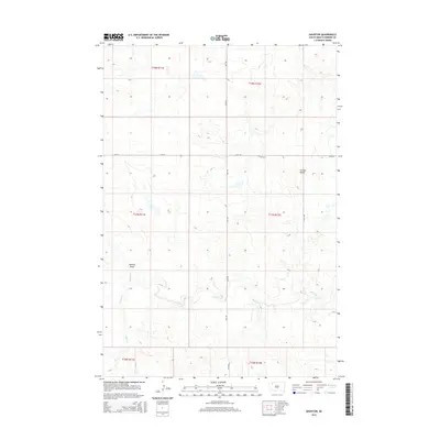
2015 Map of Daviston
USGS Topo · Published 2015About this map
Daviston serves as a central reference point in this corner of Perkins County, where the landscape is defined by the winding course of Rabbit Cr and its northern tributary, Peggy Cr. The terrain in this part of South Dakota is characterized by distinctive formations like Lotties Butte and the depressions of Mallory Draw, illustrating the drainage patterns that have shaped the High Plains. Transport and property boundaries follow the rigid grid of the Public Land Survey System, with 134th St and Date Rd providing the primary thoroughfares through the townships of t17n r12e and t18n r11e. This map documents the sparse, systematic settlement of the region, where wide-open sections of ranchland or prairie are punctuated by isolated landmarks and the occasional homestead, preserving the rural character of the area into the twenty-first century.
Find a feature on this map
14 named features on this map. Tap any name to fly to it.
Don’t see what you’re looking for? This feature index may not catch every label — zoom into the map to look around manually.
Map Details
Editions of this 2015 Daviston Map
This is the sole edition of this map. No revisions or reprints were ever made.
Other maps of this area

1954 · Lemmon
USGS Topo · 1:250,000

1957 · Lemmon
USGS Topo · 1:250,000

1983 · Grandmas Butte
USGS Topo · 1:24,000

1983 · Rabbit Butte
USGS Topo · 1:24,000

1983 · Square Top Butte
USGS Topo · 1:24,000

1983 · Sorum NE
USGS Topo · 1:24,000

1983 · Date NE
USGS Topo · 1:24,000

1983 · Date
USGS Topo · 1:24,000

1983 · Sorum SE
USGS Topo · 1:24,000

1983 · Daviston
USGS Topo · 1:24,000