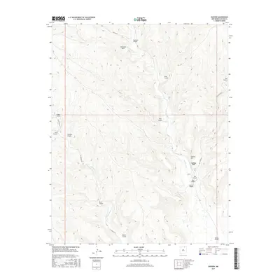
2017 Map of Dawson
USGS Topo · Published 2017About this map
The Vermejo River winds through this drainage-heavy landscape of Colfax County, centered on the remains of the Dawson settlement. Long known for its coal mining history, the terrain is defined by a dense network of deep cuts including Dawson Canyon, Box Canyon, and Rail Canyon. To the west, the watershed is fed by Van Bremmer Cr, which carves through its own named canyon alongside Van Bremmer Rd. High points like Capitan Hill overlook the river valley, while the distinctive Horseshoe Bend marks a significant meander in the north. The map traces the essential transport corridors that supported the valley's industrial past, including Rail Canyon Rd and Speilman Rd, providing a clear view of how these remote canyons were interconnected.
Find a feature on this map
20 named features on this map. Tap any name to fly to it.
Don’t see what you’re looking for? This feature index may not catch every label — zoom into the map to look around manually.
Map Details
Editions of this 2017 Dawson Map
This is the sole edition of this map. No revisions or reprints were ever made.
Other maps of this area

1915 · Brilliant
USGS Topo · 1:62,500

1915 · Koehler
USGS Topo · 1:62,500

1917 · Koehler
USGS Topo · 1:62,500

1954 · Raton
USGS Topo · 1:250,000

1955 · Cimarron
USGS Topo · 1:62,500

1958 · Raton
USGS Topo · 1:250,000

1962 · Casa Grande
USGS Topo · 1:62,500

1971 · Saltpeter Mountain
USGS Topo · 1:24,000
1971 · Curtis Camp
USGS Topo · 1:24,000
1971 · Colfax
USGS Topo · 1:24,000