
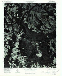
1960 Map of Dawson Crossroads
USGS Topo · Published 1964About this map
Beech Swamp dominates the central landscape of this Halifax County survey, illustrating the significant wetlands that defined the local geography and road patterns in the mid-20th century. The rural character of the area is anchored by community nodes like Crowells Crossroads and Dawson Crossroads, where small clusters of homes and services formed the social backbone of the region. Local genealogy is well-represented through numerous family-named landmarks, including the Westray and Pittman cemeteries, as well as several country congregations such as Whitaker Chapel and Mt Calvary Ch. The presence of Hales Millpond on Hales Branch points to the area's history of water-powered industry, while the Dawson School and Crowells Ch show the distribution of public and religious institutions serving the scattered farmsteads of the Halifax, Enfield, and Conoconnara districts.
Find a feature on this map
20 named features on this map. Tap any name to fly to it.
Don’t see what you’re looking for? This feature index may not catch every label — zoom into the map to look around manually.
Map Details
Editions of this 1960 Dawson Crossroads Map
This is the sole edition of this map. No revisions or reprints were ever made.
Other maps of this area

1953 · Norfolk
USGS Topo · 1:250,000

1960 · Draughn
USGS Topo · 1:24,000

1961 · Whitakers
USGS Topo · 1:24,000

1961 · Enfield
USGS Topo · 1:24,000

1962 · Scotland Neck
USGS Topo · 1:24,000

1962 · Hobgood
USGS Topo · 1:24,000

1974 · Halifax
USGS Topo · 1:24,000

1974 · Boones Crossroads
USGS Topo · 1:24,000

1974 · Darlington
USGS Topo · 1:24,000
1976 · Halifax
USGS Topo · 1:24,000