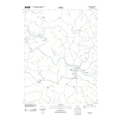
2010 Map of Dawson
USGS Topo · Published 2010About this map
Alliance Furnace stands as a testament to the early industrial heritage of the Jacobs Creek valley, where the water flows toward the Youghiogheny River. This landscape is defined by the winding river and a series of tight-knit settlements including Dawson, Vanderbilt, and Liberty. The terrain rises from the riverbanks to named heights like Layton Hill and Roundtop, while several cemeteries—Saint Johns Cemetery, Dickerson Run-Union Cemetery, and Cochran Cemetery—offer critical locations for genealogical research. The rail presence along the river remains a central feature, connecting these riverside communities through the narrow valleys of Dickerson Run and Washington Run. Modern infrastructure like the Virgin Run Dam and Arnold Farm Dam shows the continued management of the local watersheds in Fayette County.
Find a feature on this map
93 named features on this map. Tap any name to fly to it.
Don’t see what you’re looking for? This feature index may not catch every label — zoom into the map to look around manually.
Map Details
Editions of this 2010 Dawson Map
This is the sole edition of this map. No revisions or reprints were ever made.
Other maps of this area

1900 · Uniontown
USGS Topo · 1:62,500

1900 · Masontown
USGS Topo · 1:62,500

1902 · Brownsville
USGS Topo · 1:62,500

1902 · Connellsville
USGS Topo · 1:62,500

1903 · Masontown
USGS Topo · 1:62,500

1906 · Brownsville
USGS Topo · 1:62,500

1931 · Brownsville
USGS Topo · 1:62,500

1931 · Connellsville
USGS Topo · 1:62,500

1931 · Uniontown
USGS Topo · 1:62,500

1931 · Masontown
USGS Topo · 1:62,500