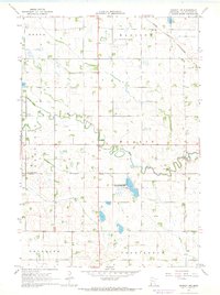
1967 Map of Dawson NW
USGS Topo · Published 1968About this map
The Lac qui Parle River and its West Branch define the agricultural landscape of western Lac qui Parle County during the late 1960s. This survey illustrates a highly organized prairie grid, where town halls and rural institutions serve as the primary landmarks between vast sections of farmland. While the Chicago and North Western railroad cuts across the northeastern corner near the Madison Municipal Airport, the interior of the quadrangle remains deeply rural, anchored by local focal points like the Garfield Ch and the Hamlin Cem. Extensive water management is evident through systems like County Ditch No 69 and County Ditch No 17, while the Hamlin State Wildlife Management Area preserves a pocket of natural wetland and marsh along the river's path.
Find a feature on this map
17 named features on this map. Tap any name to fly to it.
Don’t see what you’re looking for? This feature index may not catch every label — zoom into the map to look around manually.
Map Details
Editions of this 1967 Dawson NW Map
2 editions found
Other maps of this area

1953 · Bellingham
USGS Topo · 1:62,500

1953 · Milbank
USGS Topo · 1:250,000

1953 · Watertown
USGS Topo · 1:250,000

1958 · Milbank
USGS Topo · 1:250,000

1958 · Watertown
USGS Topo · 1:250,000

1958 · Cerro Gordo
USGS Topo · 1:24,000

1958 · Madison
USGS Topo · 1:24,000

1967 · Dawson SW
USGS Topo · 1:24,000
1967 · Providence
USGS Topo · 1:24,000

1967 · Gary SE
USGS Topo · 1:24,000