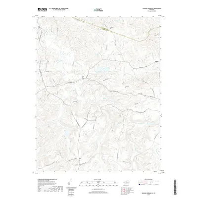
2019 Map of Dawson Springs SE
USGS Topo · Published 2019About this map
Era and Empire anchor this portion of the Western Kentucky Coal Field, where the landscape is defined by the winding course of the Tradewater River. The region’s rural character is evidenced by a high density of family and community burial grounds, including the McKnight Cem, Adams Cem, and Reynolds Cem. Local transit historically relied on water crossings like Collins Bridge and Pooles Mill Bridge, which served the network of roads connecting small settlements. Numerous tributaries such as Castleberry Cr, Sugar Cr, and Sandlick Cr carve through the terrain, illustrating a drainage pattern that influenced early property lines and road placements like Terry Coal Rd and Poole Mill Rd. The boundary between Hopkins and Christian counties runs through the northern section, dividing a territory shaped by its creeks and small-scale agricultural hubs.
Find a feature on this map
57 named features on this map. Tap any name to fly to it.
Don’t see what you’re looking for? This feature index may not catch every label — zoom into the map to look around manually.
Map Details
Editions of this 2019 Dawson Springs SE Map
This is the sole edition of this map. No revisions or reprints were ever made.
Other maps of this area

1909 · Dawson Springs
USGS Topo · 1:48,000

1911 · Dawson Springs
USGS Topo · 1:62,500

1912 · Nortonville
USGS Topo · 1:62,500

1952 · Pleasant Green Hill
USGS Topo · 1:24,000

1952 · Kelly
USGS Topo · 1:24,000

1952 · Crofton
USGS Topo · 1:24,000

1953 · Dawson Springs SE
USGS Topo · 1:24,000

1953 · Nortonville
USGS Topo · 1:24,000

1953 · Gracey
USGS Topo · 1:24,000

1953 · Dawson Springs SW
USGS Topo · 1:24,000