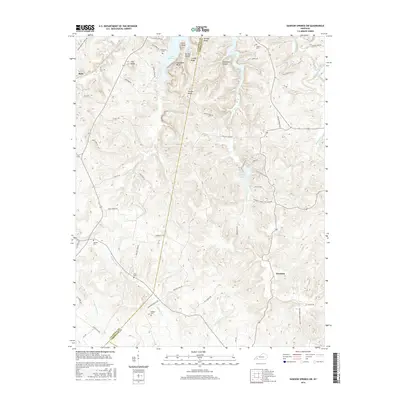
2016 Map of Dawson Springs SW
USGS Topo · Published 2016About this map
Hawkins and Ruth sit within a landscape defined by the rugged transitions between Caldwell and Christian Counties. The northern reach of the area is dominated by the waters of Lake Beshear, which wraps around landmarks like Copeland Bluff and Pine Knob. This 2016 survey documents a terrain heavily carved by waterways, including Piney Cr and Clifty Cr, which feeds into the recreational landscape of Pennyrile Lake. The presence of several family-named burial grounds, such as Vanhooser Cem, Shyflat Cem, and Rodgers Cem, provides essential data for genealogists tracing local lineage in this rural corridor. The network of winding roads like Fowler Ridge Rd and Cerulean Springs Rd follows the natural contours of the ridges, illustrating how the geography has dictated the settlement and transit patterns of these western Kentucky communities.
Find a feature on this map
63 named features on this map. Tap any name to fly to it.
Don’t see what you’re looking for? This feature index may not catch every label — zoom into the map to look around manually.
Map Details
Editions of this 2016 Dawson Springs SW Map
This is the sole edition of this map. No revisions or reprints were ever made.
Other maps of this area

1908 · Princeton
USGS Topo · 1:62,500

1909 · Dawson Springs
USGS Topo · 1:48,000

1910 · Princeton
USGS Topo · 1:62,500

1911 · Dawson Springs
USGS Topo · 1:62,500

1952 · Pleasant Green Hill
USGS Topo · 1:24,000

1953 · Dawson Springs SE
USGS Topo · 1:24,000

1953 · Gracey
USGS Topo · 1:24,000

1953 · Cobb
USGS Topo · 1:24,000

1953 · Dawson Springs SW
USGS Topo · 1:24,000

1954 · Evansville
USGS Topo · 1:250,000