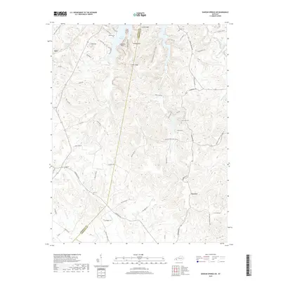
2019 Map of Dawson Springs SW
USGS Topo · Published 2019About this map
Lake Beshear dominates the northern landscape of this region, where the winding waters meet the steep terrain of Copeland Bluff and Pine Knob. This 2019 survey documents the rural boundary where Caldwell County and Christian County meet, characterized by a series of prominent ridges such as Lisanby Ridge and Fowler Ridge. The settlement patterns here are deeply rooted in the land's topography, with small communities like Hawkins and Ruth connected by a network of local roads that follow the valleys and creek beds. Numerous family burial sites, including Vanhooser Cem, Rodgers Cem, and Newson Cem, are scattered across the quadrangle, serving as vital records for genealogical research. The presence of Pennyrile Forest State Park Rd and associated recreation labels like Golf Course Rd and Bath House Loop indicates the intersection of state-managed conservation and local tourism near the waterways of Clifty Cr and Wallace Fork.
Find a feature on this map
68 named features on this map. Tap any name to fly to it.
Don’t see what you’re looking for? This feature index may not catch every label — zoom into the map to look around manually.
Map Details
Editions of this 2019 Dawson Springs SW Map
This is the sole edition of this map. No revisions or reprints were ever made.
Other maps of this area

1908 · Princeton
USGS Topo · 1:62,500

1909 · Dawson Springs
USGS Topo · 1:48,000

1910 · Princeton
USGS Topo · 1:62,500

1911 · Dawson Springs
USGS Topo · 1:62,500

1952 · Pleasant Green Hill
USGS Topo · 1:24,000

1953 · Dawson Springs SE
USGS Topo · 1:24,000

1953 · Gracey
USGS Topo · 1:24,000

1953 · Cobb
USGS Topo · 1:24,000

1953 · Dawson Springs SW
USGS Topo · 1:24,000

1954 · Evansville
USGS Topo · 1:250,000