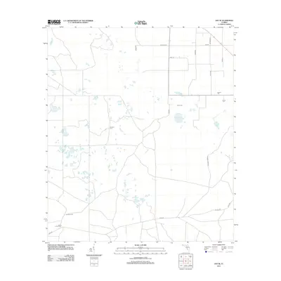
2012 Map of Day SE
USGS Topo · Published 2012About this map
Bethany Cem, Brown Cem, and Folsom Cem anchor the social geography of this rural Florida landscape, reflecting the long-standing family ties of Taylor County. The terrain is defined by a series of localized basins and ponds, such as Strayhan Pond, Old Grassy Lake, and Luke Lake, which suggest a seasonally wet environment typical of the Big Bend region. Settlement is sparse, characterized by seasonal or hunting-related sites like Paremore Camp and Brumley Camp, rather than concentrated townships. Transportation is managed through a network of local routes including State Way 350 and Co Rd 53, while the Ainsley Lookout Tower in the southwest provides a high-point vantage over the timbered flatlands.
Find a feature on this map
21 named features on this map. Tap any name to fly to it.
Don’t see what you’re looking for? This feature index may not catch every label — zoom into the map to look around manually.
Map Details
Editions of this 2012 Day SE Map
This is the sole edition of this map. No revisions or reprints were ever made.
Other maps of this area

1954 · Mallory Swamp NW
USGS Topo · 1:24,000

1954 · Fenholloway
USGS Topo · 1:24,000

1954 · Day SE
USGS Topo · 1:24,000

1954 · Day
USGS Topo · 1:24,000

1954 · Cooks Hammock
USGS Topo · 1:24,000

1954 · Salem
USGS Topo · 1:24,000

1954 · Dowling Park
USGS Topo · 1:24,000

1954 · Day NW
USGS Topo · 1:24,000

1954 · Gainesville
USGS Topo · 1:250,000

1954 · Valdosta
USGS Topo · 1:250,000