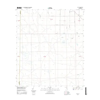
2015 Map of Day SE
USGS Topo · Published 2015About this map
The Taylor County and Lafayette County border defines the western edge of this Florida landscape, where a dense network of local roads and family-named landmarks crisscross the flat terrain. This region is characterized by small, isolated water bodies like Strayhan Pond, Sand Lake, and Old Grassy Lake, which likely influenced early settlement patterns and cattle grazing routes. Genealogy researchers will find significant value in the documentation of several rural burial grounds, including Bethany Cem and Brown Cem in the northeast, and Folsom Cem situated near the center of the survey. The infrastructure reflects a mix of traditional routes like Old Salt Rd and modern thoroughfares such as W Us 27, while many secondary roads, including SW Confederate Rd and SW Freedom Rd, suggest the local heritage and naming conventions of this North Florida community.
Find a feature on this map
36 named features on this map. Tap any name to fly to it.
Don’t see what you’re looking for? This feature index may not catch every label — zoom into the map to look around manually.
Map Details
Editions of this 2015 Day SE Map
This is the sole edition of this map. No revisions or reprints were ever made.
Other maps of this area

1954 · Mallory Swamp NW
USGS Topo · 1:24,000

1954 · Fenholloway
USGS Topo · 1:24,000

1954 · Day SE
USGS Topo · 1:24,000

1954 · Day
USGS Topo · 1:24,000

1954 · Cooks Hammock
USGS Topo · 1:24,000

1954 · Salem
USGS Topo · 1:24,000

1954 · Dowling Park
USGS Topo · 1:24,000

1954 · Day NW
USGS Topo · 1:24,000

1954 · Gainesville
USGS Topo · 1:250,000

1954 · Valdosta
USGS Topo · 1:250,000