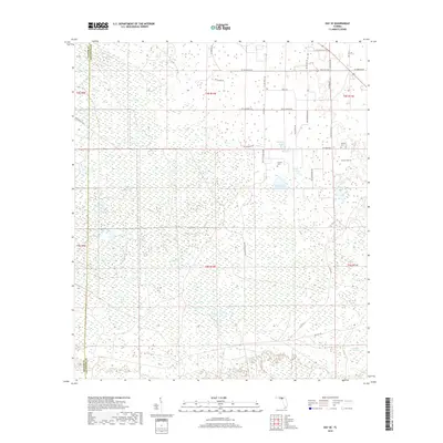
2018 Map of Day SE
USGS Topo · Published 2018About this map
The low-lying wetlands of the Florida Panhandle transition into rural farm and forest land along the boundary of Taylor Co and Lafayette Co. This landscape is defined by its distinct hydrography, featuring numerous "sogs" and bays including Tiger Bay, Big Sog, and Double Run Bay. These names reflect the historical vernacular for the region's unique marshy depressions and saturated forests. The northern portion of the map shows a more developed grid of rural roads, including SW Ford Rd and SW Cherokee Rd, which connect isolated homesteads and community landmarks. Genealogists can find several established burial grounds in this section, such as Bethany Cem, Brown Cem, and Folsom Cem, which serve as permanent records of the families that settled this portion of the Suwannee River valley hinterlands.
Find a feature on this map
45 named features on this map. Tap any name to fly to it.
Don’t see what you’re looking for? This feature index may not catch every label — zoom into the map to look around manually.
Map Details
Editions of this 2018 Day SE Map
This is the sole edition of this map. No revisions or reprints were ever made.
Other maps of this area

1954 · Mallory Swamp NW
USGS Topo · 1:24,000

1954 · Fenholloway
USGS Topo · 1:24,000

1954 · Day SE
USGS Topo · 1:24,000

1954 · Day
USGS Topo · 1:24,000

1954 · Cooks Hammock
USGS Topo · 1:24,000

1954 · Salem
USGS Topo · 1:24,000

1954 · Dowling Park
USGS Topo · 1:24,000

1954 · Day NW
USGS Topo · 1:24,000

1954 · Gainesville
USGS Topo · 1:250,000

1954 · Valdosta
USGS Topo · 1:250,000