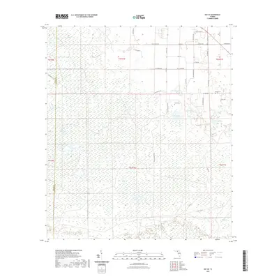
2021 Map of Day SE
USGS Topo · Published 2021About this map
Hydrological features dominated by cypress bays and sogs define this landscape along the Taylor County and Lafayette County line. The terrain is characterized by specialized wetland ecosystems, including the prominent Tiger Bay in the northwest and Double Run Bay in the southeast. Numerous ephemeral water bodies such as Horton Sog, Fire Pan Sog, and Big Sog are scattered throughout the quadrangle, illustrating the complex drainage patterns of this Florida flatwoods environment.
Find a feature on this map
45 named features on this map. Tap any name to fly to it.
Don’t see what you’re looking for? This feature index may not catch every label — zoom into the map to look around manually.
Map Details
Editions of this 2021 Day SE Map
This is the sole edition of this map. No revisions or reprints were ever made.
Other maps of this area

1954 · Mallory Swamp NW
USGS Topo · 1:24,000

1954 · Fenholloway
USGS Topo · 1:24,000

1954 · Day SE
USGS Topo · 1:24,000

1954 · Day
USGS Topo · 1:24,000

1954 · Cooks Hammock
USGS Topo · 1:24,000

1954 · Salem
USGS Topo · 1:24,000

1954 · Dowling Park
USGS Topo · 1:24,000

1954 · Day NW
USGS Topo · 1:24,000

1954 · Gainesville
USGS Topo · 1:250,000

1954 · Valdosta
USGS Topo · 1:250,000