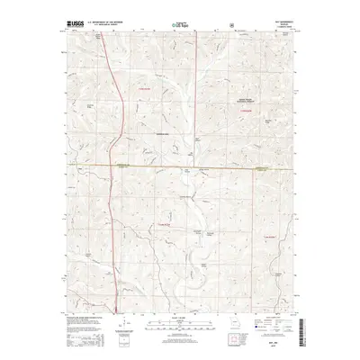
2015 Map of Day
USGS Topo · Published 2015About this map
Saddlebrooke and the village of Day sit at the intersection of rugged Ozark topography and the modern Us-65 corridor. This 2015 representation of the landscape shows the sharp dissection of the plateau by Woods Fork and Bull Cr, which create a series of prominent high points like Green Mound Ridge and Chestnut Ridge. Much of the eastern portion of the map is protected within the Mark Twain National Forest, preserving the wooded character of the numerous "hollows" that define the local geography.
Find a feature on this map
77 named features on this map. Tap any name to fly to it.
Don’t see what you’re looking for? This feature index may not catch every label — zoom into the map to look around manually.
Map Details
Editions of this 2015 Day Map
This is the sole edition of this map. No revisions or reprints were ever made.
Other maps of this area

1907 · Forsyth
USGS Topo · 1:125,000

1945 · Harrison
USGS Topo · 1:250,000

1949 · Harrison
USGS Topo · 1:250,000

1950 · Garber
USGS Topo · 1:24,000

1954 · Harrison
USGS Topo · 1:250,000

1955 · Garrison
USGS Topo · 1:24,000
1955 · Selmore
USGS Topo · 1:24,000
1955 · Chadwick
USGS Topo · 1:24,000

1955 · Day
USGS Topo · 1:24,000
1955 · Highlandville
USGS Topo · 1:24,000