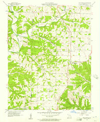
1955 Map of Highlandville
USGS Topo · Published 1957About this map
Highlandville sits at a high elevation point overlooking the dissected drainage basins of the Ozark plateau in the mid-1950s. The landscape is defined by the winding course of the James River to the west and Finley Creek to the north, with numerous family-named hollows and springs carving into the limestone topography. Small rural communities like Ponce de Leon and Montague serve as local anchors, connected by a network of unimproved roads and light-duty paths. The map is particularly dense with small family and community burial grounds, including Mayberry Cem, Lebow Cem, and Tory Cem, which are often located on high ridges or near rural houses of worship such as Pleasant View Ch. These features suggest a long-established pattern of upland farming and kinship-based settlement before the expansion of nearby regional centers.
Find a feature on this map
46 named features on this map. Tap any name to fly to it.
Don’t see what you’re looking for? This feature index may not catch every label — zoom into the map to look around manually.
Map Details
Editions of this 1955 Highlandville Map
2 editions found
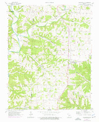
Other maps of this area

1884 · Springfield
USGS Topo · 1:125,000

1886 · Springfield
USGS Topo · 1:125,000

1907 · Forsyth
USGS Topo · 1:125,000

1937 · Ozark
USGS Topo · 1:48,000

1943 · Ozark
USGS Topo · 1:62,500

1945 · Harrison
USGS Topo · 1:250,000

1945 · Ozark
USGS Topo · 1:62,500

1949 · Harrison
USGS Topo · 1:250,000

1954 · Harrison
USGS Topo · 1:250,000

1954 · Springfield
USGS Topo · 1:250,000