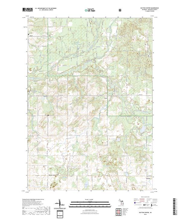
2023 Map of Dayton Center
USGS Topo · Published 2023About this map
The Manistee National Forest covers a significant portion of this Newaygo County landscape, where woodlots and wetlands define the terrain north of Dayton Center. Small rural settlements like Huber and Aetna anchor the local road grid, while the South Branch White River and its tributaries, including Martin Creek and Mena Creek, provide the primary drainage for the region. Genealogists will find several burial grounds of interest, such as the Lincoln Township Cem and the Bull Cem located near W Baseline Rd. The southern portion of the area is particularly rich in small kettle lakes and marshes, including Blackberry Lake, Cook Lake, and Dutch Lake. This modern survey illustrates the persistent rural character of the area, showing how the historic section lines and early township centers like Wooster continue to structure the community today.
Find a feature on this map
80 named features on this map. Tap any name to fly to it.
Don’t see what you’re looking for? This feature index may not catch every label — zoom into the map to look around manually.
Map Details
Editions of this 2023 Dayton Center Map
This is the sole edition of this map. No revisions or reprints were ever made.
Other maps of this area

1931 · Walkerville NE
USGS Topo · 1:31,680

1931 · Walkerville SE
USGS Topo · 1:31,680

1954 · Milwaukee
USGS Topo · 1:250,000

1954 · Midland
USGS Topo · 1:250,000

1958 · Midland
USGS Topo · 1:250,000

1958 · Milwaukee
USGS Topo · 1:250,000

1958 · Hesperia
USGS Topo · 1:62,500

1958 · Twin Lake
USGS Topo · 1:62,500

1958 · Fremont
USGS Topo · 1:62,500

1959 · Midland
USGS Topo · 1:250,000