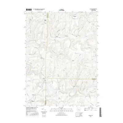
2016 Map of Dayton
USGS Topo · Published 2016About this map
Timblin and Ringgold anchor the northern reaches of this Pennsylvania landscape, where the confluence of several small runs feeds into the larger drainage network. The terrain is defined by a dense web of rural routes and family-named roads such as Sam Shirey Rd and Young S Orchard Rd, reflecting generations of land use. In the southern portion, the Mahoning Cr Lake and Hamilton Run dominate the topography near the settlement of Loop, while Dayton sits at the southwestern edge.
Find a feature on this map
89 named features on this map. Tap any name to fly to it.
Don’t see what you’re looking for? This feature index may not catch every label — zoom into the map to look around manually.
Map Details
Editions of this 2016 Dayton Map
This is the sole edition of this map. No revisions or reprints were ever made.
Other maps of this area

1901 · Rural Valley
USGS Topo · 1:62,500

1903 · Rural Valley
USGS Topo · 1:62,500

1906 · Clarion
USGS Topo · 1:62,500

1907 · Clarion
USGS Topo · 1:62,500

1909 · Smicksburg
USGS Topo · 1:62,500

1924 · Brookville
USGS Topo · 1:62,500

1926 · Brookville
USGS Topo · 1:62,500

1938 · Smicksburg
USGS Topo · 1:62,500

1939 · Smicksburg
USGS Topo · 1:62,500

1944 · Brookville
USGS Topo · 1:62,500