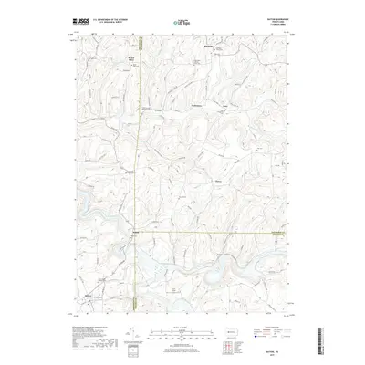
2019 Map of Dayton
USGS Topo · Published 2019About this map
Dayton and the surrounding rural townships of Ringgold, Timblin, and Porter define this landscape where three Pennsylvania counties—Armstrong, Jefferson, and Indiana—converge. The settlement pattern is anchored by small crossroads and creek valleys, with Corbettown, Dora, and Milton situated near significant waterways like Pine Run and Foundry Run. Local history is deeply embedded in the numerous denominational sites, including the Ringgold United Methodist Church and Saint James Lutheran Church, alongside family-named landmarks like Copenhaver Crossroads Cem and Emory Chapel Memorial Park.
Find a feature on this map
102 named features on this map. Tap any name to fly to it.
Don’t see what you’re looking for? This feature index may not catch every label — zoom into the map to look around manually.
Map Details
Editions of this 2019 Dayton Map
This is the sole edition of this map. No revisions or reprints were ever made.
Other maps of this area

1901 · Rural Valley
USGS Topo · 1:62,500

1903 · Rural Valley
USGS Topo · 1:62,500

1906 · Clarion
USGS Topo · 1:62,500

1907 · Clarion
USGS Topo · 1:62,500

1909 · Smicksburg
USGS Topo · 1:62,500

1924 · Brookville
USGS Topo · 1:62,500

1926 · Brookville
USGS Topo · 1:62,500

1938 · Smicksburg
USGS Topo · 1:62,500

1939 · Smicksburg
USGS Topo · 1:62,500

1944 · Brookville
USGS Topo · 1:62,500