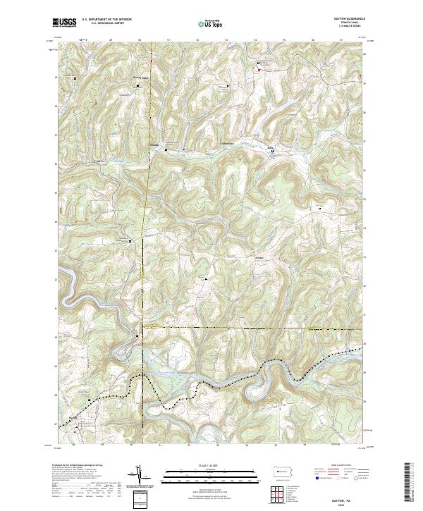
2023 Map of Dayton
USGS Topo · Published 2023About this map
Mahoning Creek winds through this rural landscape at the intersection of Armstrong, Jefferson, and Indiana counties. The terrain is defined by a high concentration of country churchyards and family burial grounds, reflecting the deep multi-generational roots of small upland settlements like Timblin, Dora, and Porter. These hamlets are linked by a network of rural routes such as Ringgold Timblin Rd and Dora Tipple Dr, the latter hinting at the region's coal mining heritage. Local history is anchored at sites like Saint James Lutheran Church Cem and Mount Tabor Cem, which stand alongside numerous smaller plots including the Fairview Cem and Copenhaver Crossroads Cem. This modern topographic study reveals a landscape where traditional community centers—churches and their associated cemeteries—remain the primary landmarks amidst the many runs and branches feeding the creek valley.
Find a feature on this map
116 named features on this map. Tap any name to fly to it.
Don’t see what you’re looking for? This feature index may not catch every label — zoom into the map to look around manually.
Map Details
Editions of this 2023 Dayton Map
This is the sole edition of this map. No revisions or reprints were ever made.
Other maps of this area

1901 · Rural Valley
USGS Topo · 1:62,500

1903 · Rural Valley
USGS Topo · 1:62,500

1906 · Clarion
USGS Topo · 1:62,500

1907 · Clarion
USGS Topo · 1:62,500

1909 · Smicksburg
USGS Topo · 1:62,500

1924 · Brookville
USGS Topo · 1:62,500

1926 · Brookville
USGS Topo · 1:62,500

1938 · Smicksburg
USGS Topo · 1:62,500

1939 · Smicksburg
USGS Topo · 1:62,500

1944 · Brookville
USGS Topo · 1:62,500