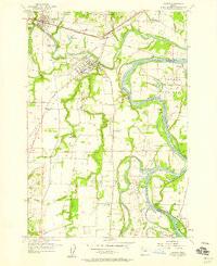
1957 Map of Dayton
USGS Topo · Published 1959About this map
The Yamhill River and Willamette River converge in this mid-century portrait of Oregon’s fertile valley floor. Agriculture and river geography dominate the landscape, from the Red Hills of Dundee to the broad expanses of Dayton Prairie and French Prairie. Small communities like Dayton and Lafayette are connected by the Southern Pacific railroad and Pacific Highway West, with a significant segment of new road marked as Under Construction north of town.
Find a feature on this map
55 named features on this map. Tap any name to fly to it.
Don’t see what you’re looking for? This feature index may not catch every label — zoom into the map to look around manually.
Map Details
Editions of this 1957 Dayton Map
4 editions found
Other maps of this area

1916 · Tualatin
USGS Topo · 1:62,500

1923 · Mount Angel
USGS Topo · 1:62,500

1924 · Mc Minnville
USGS Topo · 1:48,000

1926 · Mc Minnville
USGS Topo · 1:62,500

1939 · Tualatin
USGS Topo · 1:62,500

1940 · McMinnville
USGS Topo · 1:62,500

1940 · Tualatin
USGS Topo · 1:62,500

1940 · Mount Angel
USGS Topo · 1:62,500

1941 · Yamhill
USGS Topo · 1:62,500

1942 · Yamhill
USGS Topo · 1:62,500