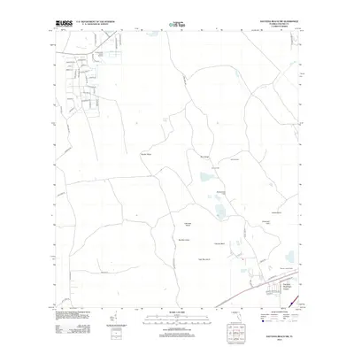
2012 Map of Daytona Beach NW
USGS Topo · Published 2012About this map
Daytona Highridge Estates anchors the southeast corner of this coastal Florida landscape, while the northwestern reach is defined by a dense residential grid with streets named for trees, such as Hemlock Dr and Ponderosa Dr. The central and eastern portions of the map are characterized by a distinct pattern of raised terrain and wetlands, featuring named high points like Bumcombe Hill and the long north-south stretches of Gopher Ridge and Rima Ridge. These ridges are interspersed with islands of dry ground surrounded by seasonal water, including Tiger Bay Island, Little Bear Island, and Big Bear Island. Historical land use is evident in clearings like Old Clark Field and Bennett Field, while aviation interests are represented by the Cross Creek Farms Airport. The area’s hydrological network is dominated by the Priest Br drainage and several small bodies of water such as Indian Lake and Scoggin Lake.
Find a feature on this map
61 named features on this map. Tap any name to fly to it.
Don’t see what you’re looking for? This feature index may not catch every label — zoom into the map to look around manually.
Map Details
Editions of this 2012 Daytona Beach NW Map
This is the sole edition of this map. No revisions or reprints were ever made.
Other maps of this area

1937 · Ormond
USGS Topo · 1:48,000

1944 · Ormond
USGS Topo · 1:62,500

1952 · Samsula
USGS Topo · 1:24,000

1952 · Daytona Beach
USGS Topo · 1:24,000

1954 · Daytona Beach
USGS Topo · 1:250,000

1956 · Favoretta
USGS Topo · 1:24,000

1956 · Ormond Beach
USGS Topo · 1:24,000

1958 · Daytona Beach
USGS Topo · 1:250,000

1962 · Daytona Beach NW
USGS Topo · 1:24,000

1962 · Daytona Beach SW
USGS Topo · 1:24,000